Geoneon Joins the Digital Earth Pacific Program to Support Climate Resilience Across the Pacific
We are proud to announce that Geoneon has signed a major contract to support the Pacific ...
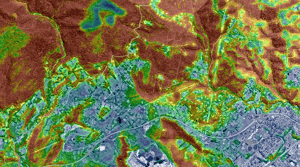
Monitoring Forest Clearing Using Satellite Data and AI-Derived Vegetation Height
Understanding how vegetation changes over time is essential for managing forests, ...
Geoneon Named Finalist in Three Categories at the 2025 Australian Space Awards
We are proud to announce that Geoneon has been shortlisted for three awards at the ...
Geoneon’s CEO Meets the Prime Minister of Bhutan to Advance Climate Resilience and Forest Fire Preparedness
Last week marked a proud moment for Geoneon as our CEO, Roxane Bandini-Maeder, had the ...
Tracking Vegetation Change: Geoneon’s Mapping of Tasmania’s Vegetation
Understanding how vegetation changes over time is important for environmental management, ...
Geoneon’s CEO Joins UN Women’s Effort to Help Bridge the Gender Data Gap
We are proud to share that Geoneon’s co-founder & CEO, Roxane Bandini-Maeder, has ...
Geoneon Wins SwissCham Australia’s Newcomer of the Year Award
We are excited to share that Geoneon has been named Newcomer of the Year at the Swiss ...
Bushfires in Northwest Tasmania: How Sentinel-2 and SWIR Can See Through the Smoke
Using a real-world case study from northwest Tasmania to demonstrate the power of ...
Mapping Tasmania’s Vegetation Height: A New 10m Resolution Dataset
Vegetation height plays a critical role in understanding landscape dynamics, wildfire ...
