

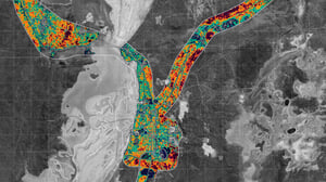
The Shire of Dundas, with the support of National Disaster Risk Reduction Grant Program, and in association with the Freight and Logistics Council of Western Australia engaged Geoneon to undertake a proof-of-concept project combining earth observation data, machine learning, and advanced modelling to:
✅ Conduct vegetation analysis and infrastructure identification.
✅ Analyse exposure and vulnerability of infrastructure and supply chains to wildfire.
Learn more here: https://case-studies.geoneon.com/wildfire-impact-dundas
05 January 2023< 1 min read
Wildfire Severity and Vulnerability Model
Have a project or question in mind?
Tell us what you need to understand or decide. We can help assess what spatial evidence and analysis would be useful.